Its image is everywhere -- on labels of tostadas and tortillas, wall murals, and even in the logo of the local baseball team. It’s the symbol of the city. The most recognizable landmark. It is as iconic as Rio de Janeiro’s Sugarloaf or Cape Town’s Table Mountain.
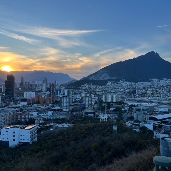
Cerro de la Silla.
Translated from Spanish as the “Saddle Hill”, the top of this mountain indeed looks like a saddle. On the way from Monterrey airport, it was the first thing that we saw approaching the city. And no matter where we went, the silhouette of the mountain was always visible and a great point of reference in the big city. We even had a view of it from our Airbnb.
Because we came to Monterrey for hiking, climbing Cerro de la Silla was easily a “must” for us. We chose the most popular hike -- Las Antennas -- leading to one of the four mountain peaks, with a side view of the famous “saddle” formation.
But initially, we were confused. There were conflicting online reports about how long the hike would take. Some people claimed it was just 4-5 hours; others said it took them almost the entire day, as it was an 11 km out and back. The only way to find out was to hike it ourselves.


To get to the start of the trailhead, we took an Uber from our Airbnb. The driver took us through a residential neighborhood and dropped us off at a dead end that marked the trail entrance.
Here’s the hard truth: the hike was difficult, and we would not recommend it to beginners. We didn’t have to scramble or use ropes or special equipment, but the ascent was a steep, punishing climb. No flat stretches, plateaus or valleys to rest on, just a relentless push all the way to the summit.
The first two hours were somewhat manageable. We left early in the morning, with the sun hanging low, and trudged on the bumpy service road through the forest. At the 2,600 meters mark, we reached the first viewpoint -- an observation platform that looked like a roof of an abandoned construction project. The view of Monterrey and the valley was expansive and unobstructed, with the city magnificently spread in front of us.
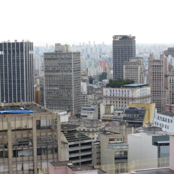
The landscape was dreamlike. Cerro de las Mitras, on the opposite side, although named for looking like the bishop’s mitre (the tall ceremonial hat), in fact looked more like the back of a sleeping dinosaur with its ridge line resembling a series of rounded humps. The light-colored concrete houses built on the slopes of that mountain created a surreal impression of pale waves rolling up the mountainside. And what’s more, from above, Monterrey appeared as it was built from white-colored stone. Later, I checked if the city’s nickname is “white city”, and for some reason, it isn’t.
The view was idyllic and was only disturbed by the persistent locals -- coatis --who begged hikers for food. These adorable creatures were curious but not too aggressive. One of them even smelled our backpack and poked its nose into it but didn’t try to rip it open as any monkey in Southeast Asia would surely have done without hesitation.
For most people, the platform was the destination. So, it seems, those who claim that it takes 4-5 hours to do the hike refer to making it to the platform and back. But we were not turning back halfway.


For the next two hours, we really tested ourselves by climbing up the mountain and trying to reach the summit. In the morning, when we got on the trail, the “saddle” looked so high above us, but now, as we kept pushing up, we started to level with it. As we continued to ascend, the views of the city were now almost as if we were flying over Monterrey. At one viewpoint, I looked down at the city and even felt a little bit dizzy. The experience reminded me of sitting in the nosebleed section of the Azteca Stadium several years prior and staring at the field.
And speaking of stadiums, from the mountain we had a bird’s-eye view of the Monterrey Stadium with its unique steel design well representing Monterrey -- once a hub of Mexican steelmaking. Marveling at the venue from above, I made a wish to return to Monterrey several months later for the World Cup and do some reverse ogling: to see the mountain from the stadium seats.
We finally reached the top. To our surprise, there was no official platform or viewpoint. The service station by the antennas with giant satellite dishes was the place where most people considered the hike to be over. The station’s guard dog relentlessly barked at us, and soon a service worker came out and told us that we were not supposed to be there and needed to leave. We snapped a couple of pictures and headed down.


Those who want to hike to one or both peaks of the “saddle” can continue from here. But the trail is more treacherous and winds through overgrown vegetation as one of the local hikers explained to us. Nor did we want to add more to this already tiring day. We needed to get down.
The descent was not easy. Going down puts a lot of pressure on your ankles, and we overextended these muscles by descending on stiff, tired legs. My knees couldn’t bend much and were aching. But the worst part: my toes were in agony as I felt every rock I stepped on. It made me question if I even had the proper hiking footwear. With the soreness setting in, the hike was getting harder by the minute. Julia handled it better, moving at a slower pace and deliberately choosing each step. By the time we left the park, we were exhausted. Did we underestimate the entire undertaking and our abilities? Probably. All in all, it took us 8 hours total to complete the hike. It’s possible to finish it in 5-6 hours, but only if you move faster and don’t stop to admire the views, eat lunch, or interact with coatis.
For the next few days, as we continued to explore Monterrey, we could barely move our feet and especially struggled going up or down the stairs. But to paraphrase Evel Knievel, “pain is temporary, glory is forever.” Every time we gazed at the iconic Cerro de la Silla, we would proudly point and say, “Can you believe it, we were up there!”
And honestly, it was hard to believe.