“It looks like a claw,” Victor said.
We zoomed in to the bottom left corner of the island of Ireland on Google maps, and I clearly saw a claw with five crooked digits protruding into the ocean, the five southwestern peninsulas. The peninsulas, Mizen, Sheep's Head, Beara, Iveragh, and Dingle, each with its own distinct personality, are a mere 5-hour drive from Dublin. Usually, tourists favor the Ring of Kerry on Iveragh and a tour around Dingle before leaving northwards for the more popular Cliffs of Moher, but we had other plans. In detail, our plans were as follows:
Day 1. Mizen and Sheep’s Head peninsulas
On our very first day of peninsula exploration, we drove through Mizen, admiring wild woodlands and half-hidden villages, until we reached what is traditionally regarded as the most southerly point of mainland Ireland, Mizen Head. I can post hundreds of pictures of the dramatic cliffs, but none will do it justice. It is no surprise that Mizen Head is a major tourist attraction; every step provides a new picturesque view of the endless ocean and cliffs hosting an old signal station, a weather station, and a lighthouse. The tip of the peninsula is almost an island, cut off by a deep chasm from the mainland, spanned by a bridge, aptly named “Mizen Bridge”. Once over the bridge, we explored the signal station, which is now a museum, housing displays of this site's strategic significance for transatlantic shipping and communications. This might sound boring, but honestly, it was fascinating. I was captivated by the story of a young Italian inventor, Guglielmo Marconi, who created the first practical radio wave-based wireless telegraph system, and a surprise twist ending where it turns out he was a Nazi all along. After 3-4 hours exploring Mizen, we moved on to the next peninsula.


Sheep’s Head was, unsurprisingly, full of sheep. On the side of every road, on every hill, and in every valley, we saw fluffy sheep with purple, green, and blue markings to indicate which flock they belonged to. As we drove deeper into Sheep’s Head, the roads became narrower, the shrubbery more overgrown, and the landscape steeper. The final portion of the journey towards the tip of the peninsula was so abruptly vertical that it felt as if we were driving straight into the sky. After parking our car and hiking up a narrow path leading between meadows and rocky hills, we were rewarded with edge-of-the-world views of the unadulterated stretch of this coastline, the roaring ocean, and a tiny lighthouse.


Day 2. Beara Peninsula
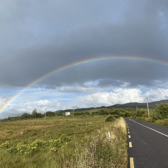
The Beara Peninsula, like Mizen and Sheep’s Head, is mostly ignored by tourists, as the roads are too narrow for tour buses and the competition from the nearby Ring of Kerry and Dingle diverts rushed-for-time tourists from exploring this tranquil and unspoiled land. We drove through the peninsula with frequent stops to explore the varied scenic coast, taking our time for short hikes. The first hike was to the tallest standing Ogham Stone Circle in Ireland, a prehistoric monument preserved on a small hill with a stunning view. We were lucky to be the only ones there.
“This is the type of place where one needs to recite poetry,” Victor said.
We stood in silence. Neither of us knew any Irish poetry.

Our next stop was by some dramatic, sea-washed cliffs. As I lingered behind, trying to figure out if I needed to wear my warmer jacket, Victor took off towards the cliff edge. By the time I left the car, Victor was no longer in view. I strolled towards the drop-off, absolutely convinced that a lower platform or a path was leading to lower ground, currently obscured from my view, where I would find Victor. I approached the edge and looked down.
I was staring directly into a twenty-foot drop where raging waves were beating against silver rocks.
“Victor!” I yelled into the abyss, as if any of this made any sense, “VICTOR!!!”
“Excuse me!” I looked up and saw an older woman pointing further right, “He went that way!”
I thanked her and ran that way. The cliff edge in that direction didn’t look any different than where I initially approached it, but as I got closer, I saw that this rim had a gentle slope leading to lower ground, where Victor was sitting on a large rock, mesmerized by the view.

Later that afternoon, we purchased local stinky cheese, some bread, and fruit at a small shop and had a lovely picnic by the coast. We also had a quite entertaining stop at the “world-famous” McCarthy Bar. But the Beara Peninsula was not done with us yet. We finished off the day on one of the most unique roads in the whole of Ireland, the Healy Pass. This serpentine-like track weaves across the boundless countryside, twisting and turning through mountainous terrain, offering plenty of opportunities to pose for pictures or just admire the view. The best view is at the highest peak of the Healy Pass, where there isn’t a lot of room to pull over and park. But this was not a problem for us, as once again, we were the only ones there. None of this made sense. Every tourist in Ireland should be here, enjoying the sunset over the lake, valley, and mountains of the Beara peninsula. Instead, we stood there alone, soaking in the view, in total silence.
Mostly because we still didn’t know any Irish poetry.

Day 3. The Gap of Dunloe on Iveragh Peninsula.
We already have a very detailed post about this day, how we hiked and ran through the Gap of Dunloe. Also, I peed in a field. Highly recommended read.
Coming up next: We discover where all the tourists are – Iveragh and Dingle peninsulas.