I must admit the title of this post is a little bit of an oxymoron. Considering we had to repeatedly explain to our friends and relatives that we were going to an island in the Caribbean and not to a city in southern Spain (spelled as Granada), writing about non-touristy things in Grenada seems somewhat contradictory. The entire island is one off-the-beaten-track destination.
For many people who visit, Grenada is usually one of the stops on a multi-day Caribbean cruise itinerary. Those who disembark here typically spend time around the colorful capital, St. George’s, or at nearby Grand Anse Beach (one of the best in the Caribbean), both located in the southwestern part of the country. Some curious souls do hop in a taxi to explore the island, but given time constraints, they rarely venture to its remote corners. And that’s a shame. Having spent eight days in Grenada—four of which involved driving around the country—we were able to find some hidden gems. The north and the east were especially wild and untamed.
Sauteurs in the north is a good starting point for exploring the lesser-known side of Grenada. The town is bookended by two wonderful beaches—David (pronounced Daavee) to the west and Levera to the east.
Getting to David Beach was an adventure. Following a narrow, sometimes even unpaved, road in a jungle, we drove our compact red Toyota Nagoya directly to the beach, parked it between palm trees, and went for a swim. The beach was serene and secluded. We shared it only with loud seagulls flying over our heads and fishermen tending their nets on the shore.
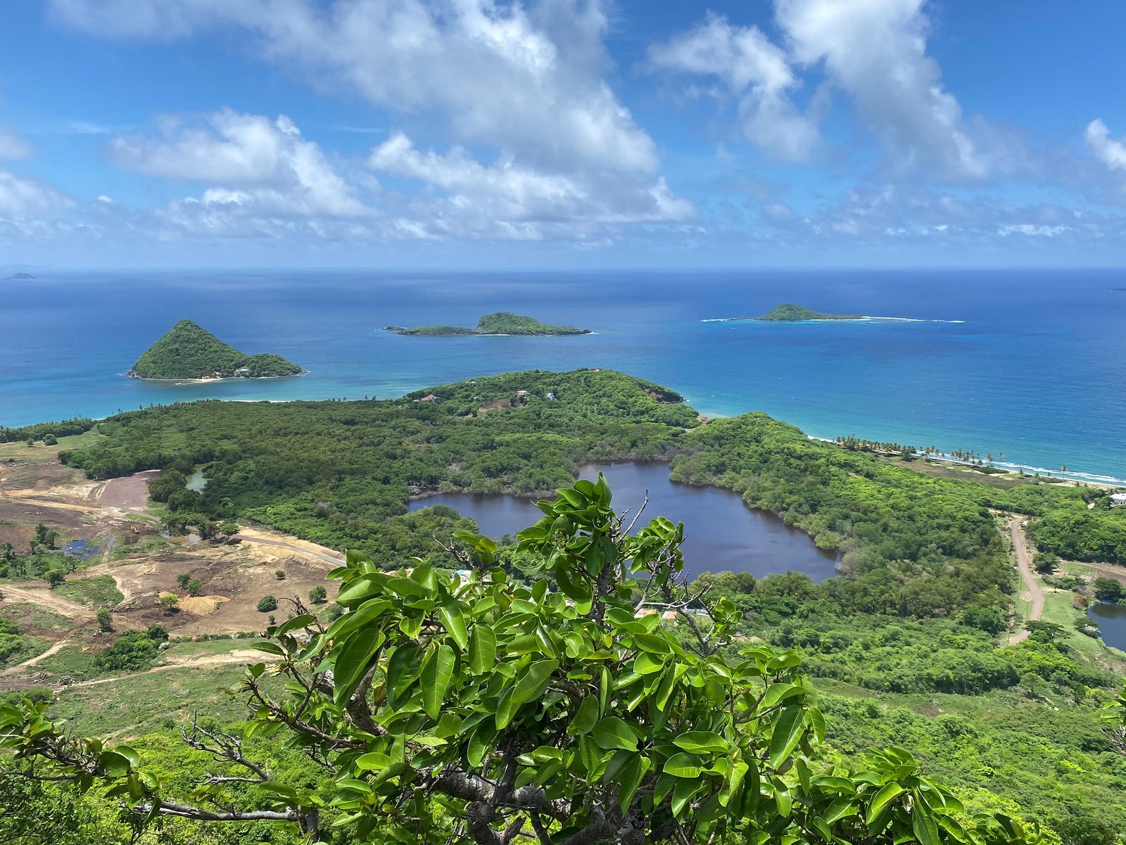
Levera Beach was a great place for two reasons. Although it was difficult to swim due to strong currents, the beach was breathtakingly beautiful, rewarding us with a view of the perfect volcano cone of Sugar Loaf Island and other nearby islands. The other reason Julia described in one of the prior posts. Here, in the middle of the night, we witnessed the miracle of nature, seeing a giant leatherback turtle lay eggs.


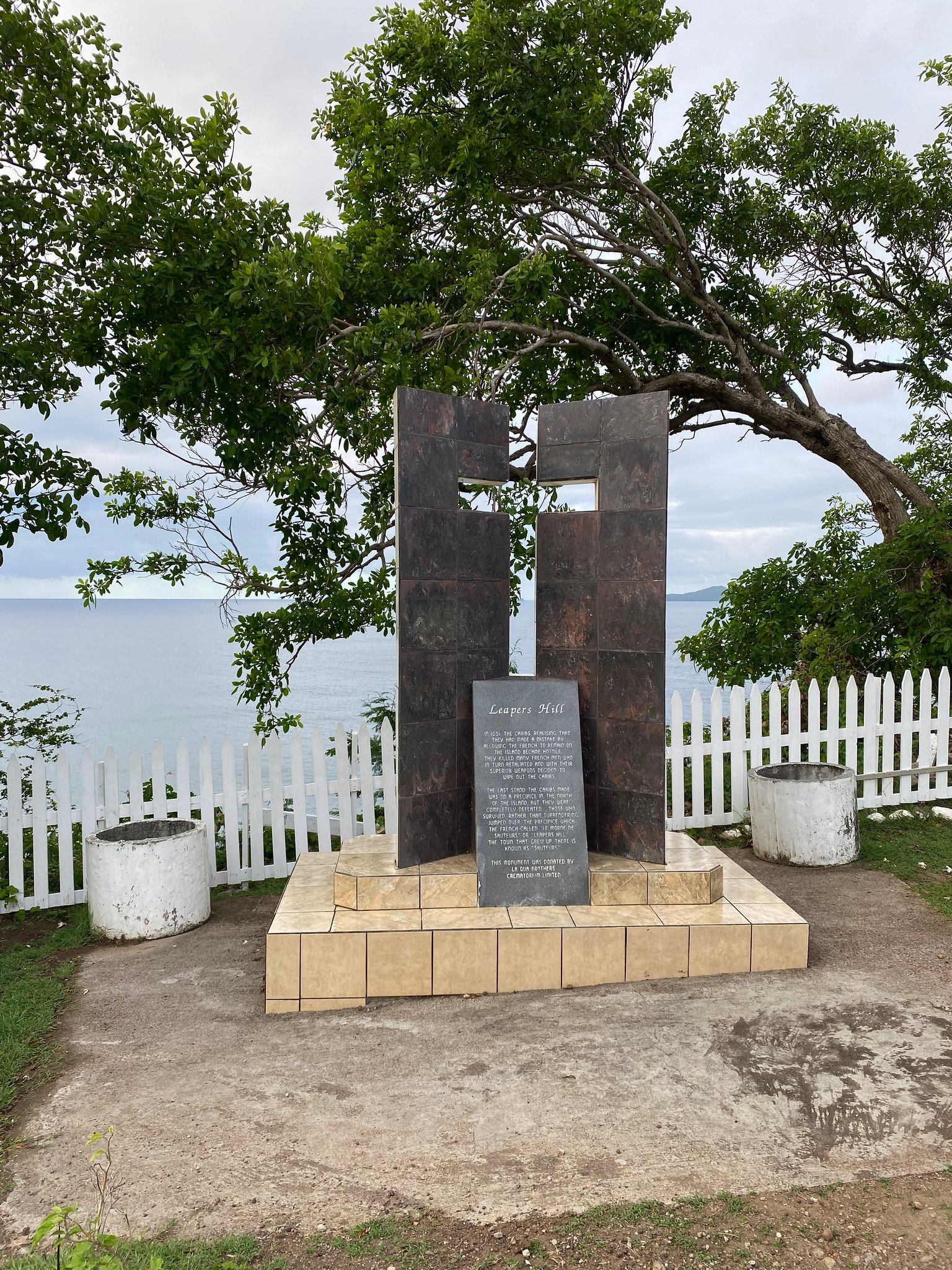
Sauteurs is a small town whose skyline comprises the steeples of two churches. It's quiet and in no way caters to mass tourism or possibly any tourism. We stayed overnight at an Airbnb nearby and found there weren’t many dining options. We ended up buying a few groceries in a local store for dinner and had to drive around in the morning to find breakfast. But the town warrants a stop as it holds the country's collective memory. It was here, in 1651, at Leapers Hill—a tall bluff overlooking the Caribbean Sea—that the last of the Carib Indians jumped to their deaths to avoid surrendering to the advancing French colonizers. It took us a while to find the exact spot, but we eventually located the monument dedicated to this event and even briefly joined a tour led by an enthusiastic local guide. She was so happy to see us because visitors are rare in this part of the island.

One of the best reasons to come to Sauteurs—in addition to doing a turtle tour at Levera Beach—is to hike to the Welcome Stone, a viewpoint at the top of the mountain overlooking Levera National Park and the Caribbean Sea. Despite being incredibly beautiful and offering arguably the best views in the country, the place is not heavily advertised. Most travel guidebooks don't even mention it. Most likely, it has to do with the fact that there is no official or authorized way to see it. The Grenada Board of Tourism website does mention it but omits any details, leaving it up to intrepid travelers to figure out how to get there.
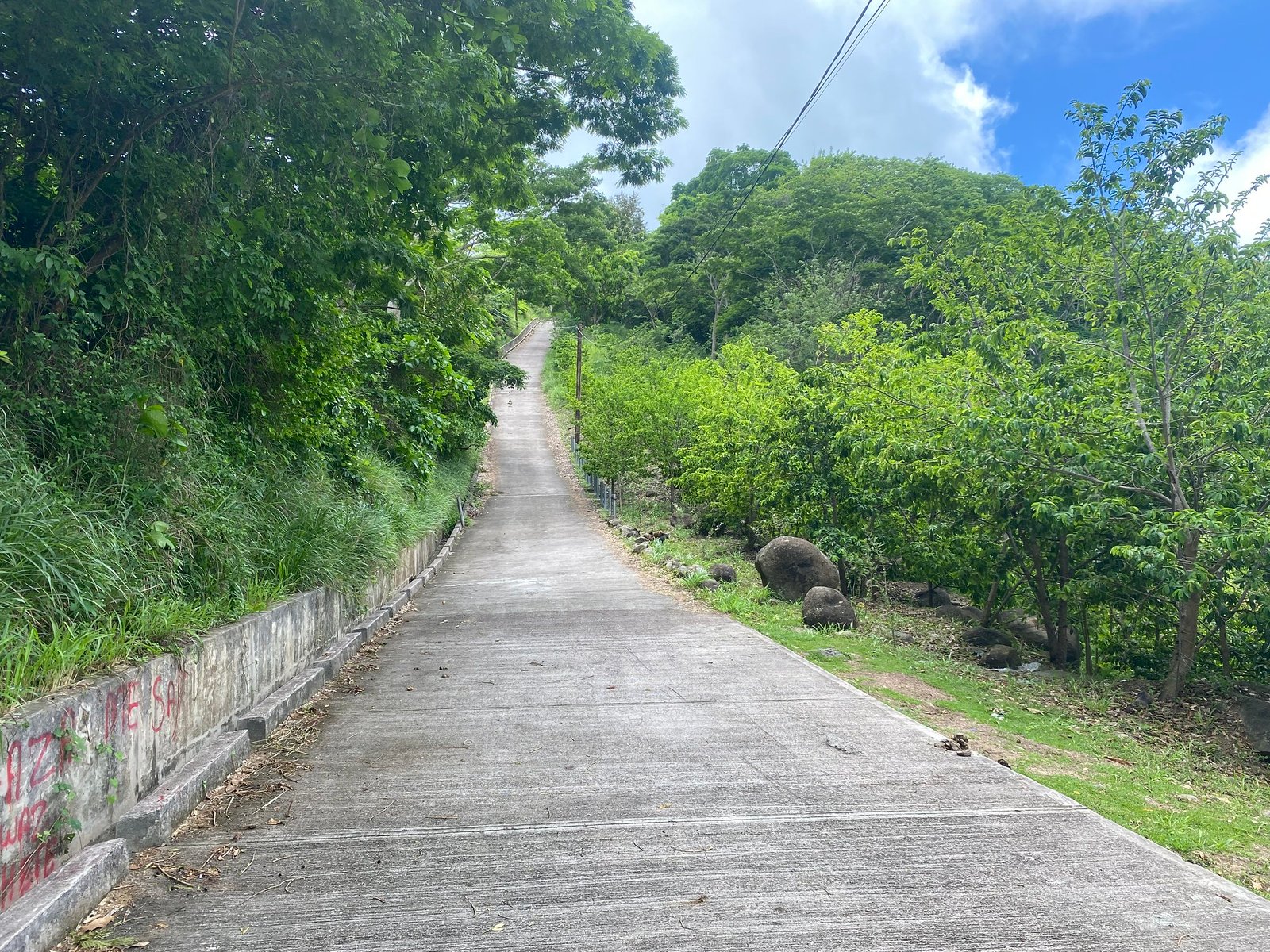
Initially, our plan was just to drive to the viewpoint. We followed the directions from Google Maps, with the road twisting and turning and steadily going up. The last 200 meters were so steep that our rental car simply gave up in the middle of the slope. We had to back up, leave it on the side of the road—there was no parking lot—and hike the last leg.
The hike was short, but it was quite challenging. At times, we had to climb at a nearly 45-degree incline. What is more, when we got to the end of the paved road, no signs were directing us to the Welcome Stone. Nothing. Instead, we stared at the massive power station surrounded by an enclosure. We rounded it and followed a barely visible trail into the bushes and then into the forest. The trail went up and down, but we had no idea where we were going. The map on the phone was now useless, showing us at the top of the mountain. Finally, when the doubts about this whole endeavor started to creep in, we saw a clearing in the path, opening a way to a cluster of boulders, from which there was an astonishing view. The white sands of Levera Beach, the Caribbean Sea shimmering with different shades of blue, and the greenery of the islands—this crazy hike was well worth it. We climbed atop a boulder and breathed fresh air, taking in this postcard-pretty view. And the mind-blowing part was that we didn't see anyone on the trail, and nobody was at the viewpoint the entire time we were there. This gorgeous view was ours and ours only!


To cap our exploration of Grenada’s north, we drove past desolate yet beautiful Bathway Beach and then continued to the even less visited and remote eastern part of the island.
An abandoned airport, a vintage rum distillery, and many more. Next time, read about our adventures in the wild east!

